Eagle Cap Wilderness Adventures
Eagle Cap Wilderness is a sprawling preservation in northeastern Oregon, known for its rugged, alpine landscapes and diverse outdoor opportunities.
Popular Activities
Plan Your Visit
Everything you need to know to prepare for an unforgettable trip to Eagle Cap Wilderness.
Entrance Requirements
Wilderness permits required for entry; no fees.
Best Time to Visit
Summer through early fall is ideal for clear skies and accessible trails.
Visitor Information
Closest ranger station is Wallowa Mountains Visitor Center in Enterprise.
Getting There
Trailhead access via Highway 82; some roads may require high clearance vehicles.
Weather & Climate
Summers are mild with daytime highs in the 70s and 80s, cooling significantly at night. Winters are harsh, with significant snowfall making many areas inaccessible.
Conservation Efforts
The wilderness faces challenges from invasive species and the effects of climate change. Efforts are ongoing to preserve its unique ecosystems and protect native wildlife, including endangered species such as the gray wolf.
Camping in Eagle Cap Wilderness
Find the perfect spot to stay overnight and immerse yourself in the details.
Moss Springs Campground
Located at the edge of the wilderness, offering basic facilities and serene forest surroundings.
Scotts Campgrounds
Accessed via a challenging hike; offers solitude and direct immersion in wilderness.
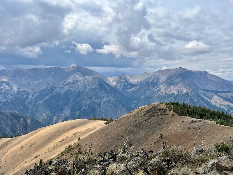
Top Trails
East Fork Lostine River Trail
Features breathtaking views of mountain peaks and pristine lakes along an undulating terrain.
Hurricane Creek Trail
Known for its stunning views of Sacajawea Peak and varied alpine ecosystems.
Ice Lake Trail
This trail rewards hikers with views of picturesque glacial lake settings and steep mountain backdrops.
Matterhorn via West Fork Wallowa Trail
Leads to one of the tallest peaks with panoramic views across the entire wilderness area.
Trailblazer Tips
Start hikes early in the day to avoid afternoon thunderstorms typical in the region.
Late summer and early fall offer the best weather, with cooler temperatures and less chance of rain.
Wilderness permits are required for all trailheads, so plan your entry points in advance.
Bring water purification gear; natural sources are plentiful, but treatment is essential.